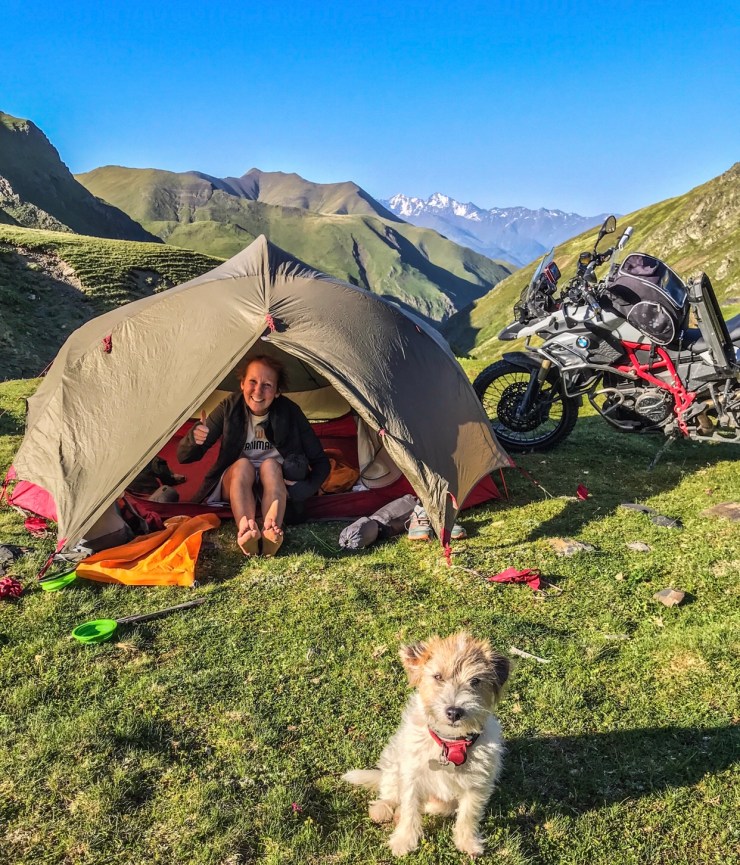
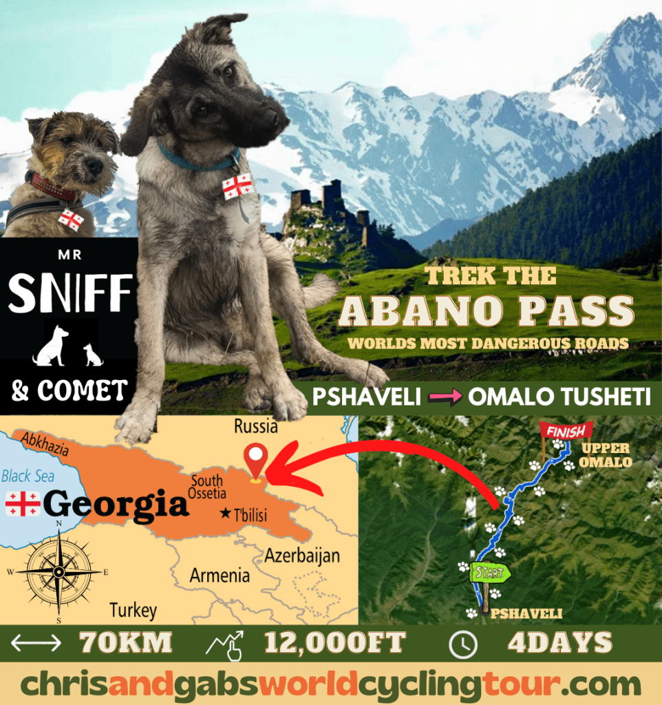
Yes this furry little pair of doglets are at it again, this time Mr Sniff and Comet will be trekking over one of the worlds most dangerous roads ‘The Abano Pass’ ..their little paws will take them over 70km of extremely harsh terrain, at a total ascent of over 12,000ft, they plan to complete their expedition in just 4 days, so will need to cover 18km each day, uphill !! – which is some going, especially when you take into account that
Mr Sniff has only just recently started to walk on all 4 legs, due to an old injury where a car hit him and broke his back leg, but Mr Sniff’s best buddy ‘Comet’, said that Mr Sniff will soon be ready for the task ahead.
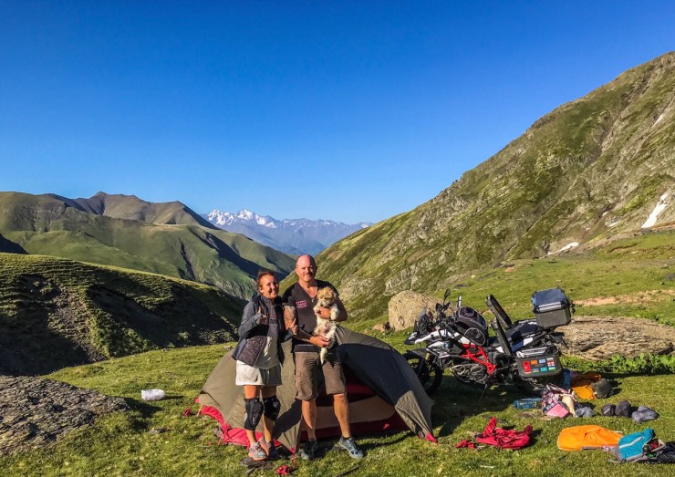
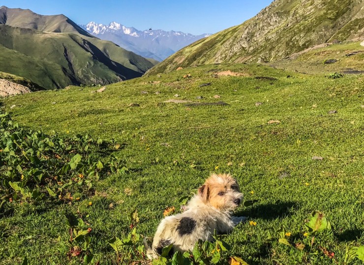
The sprightly duo are no strangers to adventure, in fact they have both spent the last few weeks together training in the Caucasus Mountains of Georgia, the same place where we found Mr Sniff abandoned just over a month ago.
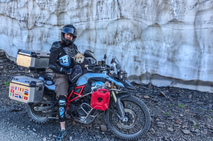
Due to the extremely rugged and steep mountainous terrain, they plan to travel very light, to prevent getting blisters on their paws, so they will be carrying just a small tent and a thermal doglet jacket each,
as the temperatures can get pretty cold up in the mountains of Tusheti, oh yes, and of course a bag of their favourite doggie biscuits, and luckily in the Caucasus mountains, theres no shortage of fresh water, in fact theres over 25,000 rivers, so no need to be carrying too much water.
The Abano pass is 85km start to finish, with no human civilisation in between, just horses, cows, sheep and wild goats, and of course theres the brown bears, deer and otters, plus many other species!
Mr Sniff has his own fundraising page, as he’s s trying to raise some money to fly to the UK, to read more about Mr Sniffs story and watch a short film about his current progress here in Georgia, click on the link below:
https://www.justgiving.com/crowdfunding/mrsniff?utm_term=ZdVDvR7X4
Below you can read a little about the Abano Pass, and Omalo.
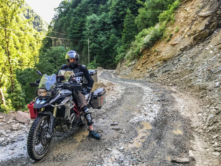
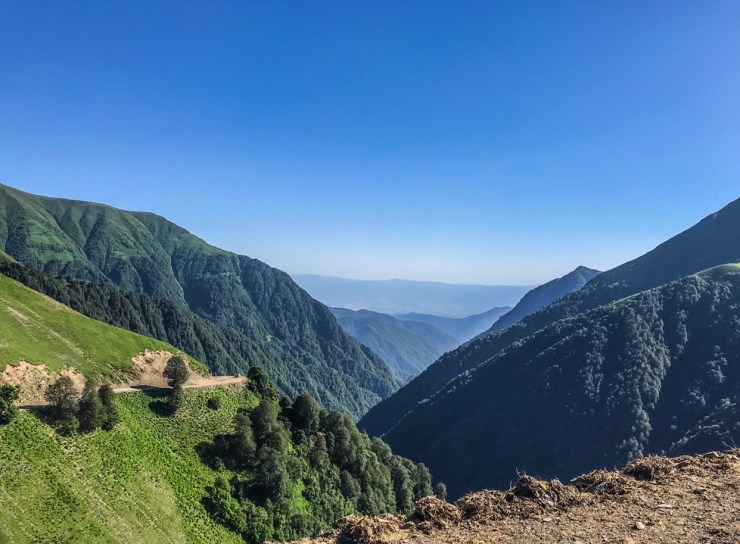
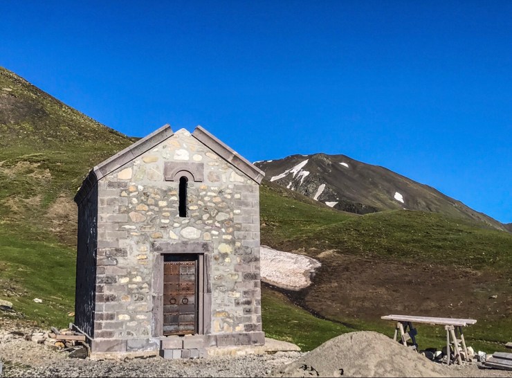
The Abano Pass is a high mountain pass located in the region of Tusheti, Georgia, in the central part of the Great Caucasus Mountains, at an elevation of 2.850m (9,350ft) above the sea level. The Abano Pass is the highest drivable mountain pass in the Caucasus, but 4×4 vehicles with high clearance, and off road motorcycles only.
The road over the pass was built in 1978, and is only open during the summer months from around May to October (depends on weather conditions) but it can be closed anytime when the access is not cleared of snow. Avalanches and heavy snowfalls can sometimes block some sections of the road and can be extremely dangerous due to frequent patches of ice. The main settlement in the region is the Omalo Village (1850 m.s.l.) Due to Omalo’s high mountain location on the northern slopes of the Greater Caucasus Mountain Range and the absence of well-maintained roads, it is largely isolated from the rest of Georgia for most of the year.

The Famous Abano Pass – Tusheti Georgia 
One of the worlds most dangerous mountain passes
The road to reach the pass runs from Pshaveli to Omalo, which is the route Mr Sniff and Comet will trek.
It has a length of 84,5km (52 miles), the expected driving time is over than 12 hours. The pass links the Georgian regions of Kakheti (south) and Tusheti (north). Tusheti is the most pristine and remote mountain region of Georgia at 900-4800 meters above sea level. It is covered with ravines and two main river valleys, Gometseri Alazani and Pirikiti Alazani. It’s one of the highest roads of Europe.
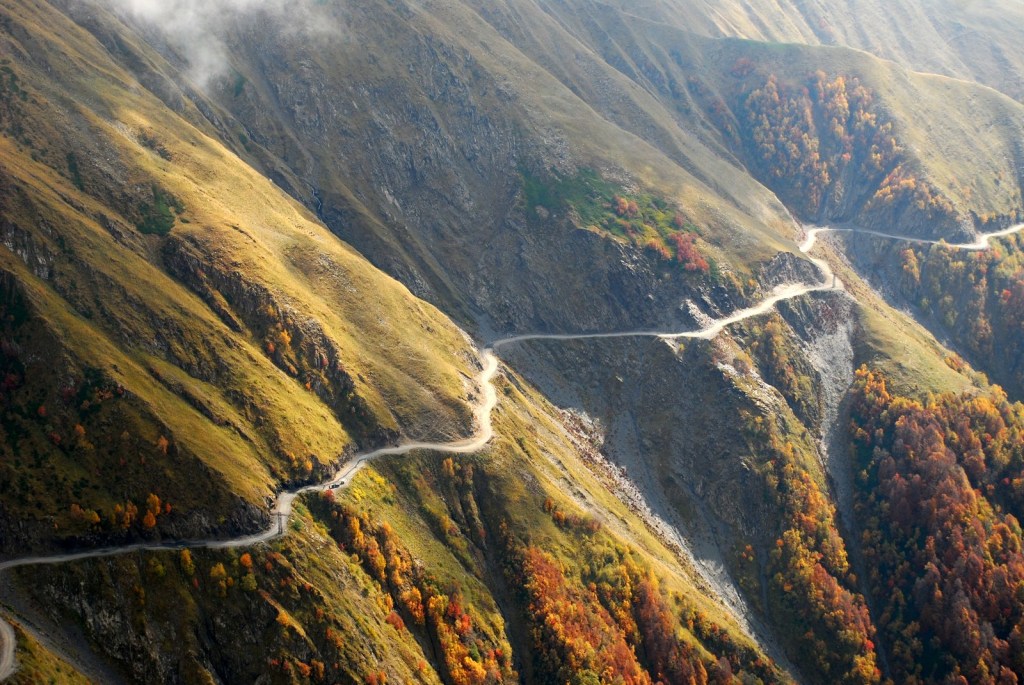

This track can get very muddy and slippery after rain making it challenging to get through. During and after a storm the road may be impassable, even with a four-wheel-drive vehicle.
Situated deeply in beautiful Caucasus mountains, it is well known as a “death road” because of many fatal accidents. It is connecting Kakheti region with Tusheti region. The road appeared in an episode of the BBC’s World’s Most Dangerous Roads a few years ago. The road is a combination of a rough and unpredictable surface, seemingly endless tight turns, steep climbs, no guard rails, deep gorges, and waterfalls gushing. The road is classed as a national route and its numbered M44 (მ44). It needs constant attention and there are many emergency call outs to clear landslides or spots where the road has slipped away. Landslips are a problem and can close the road for days. Due to weather and road conditions, especially in the mountains, caution is required. Along the way are numerous roadside memorials to those who have perished on the road. Animals are frequently encountered on the way.

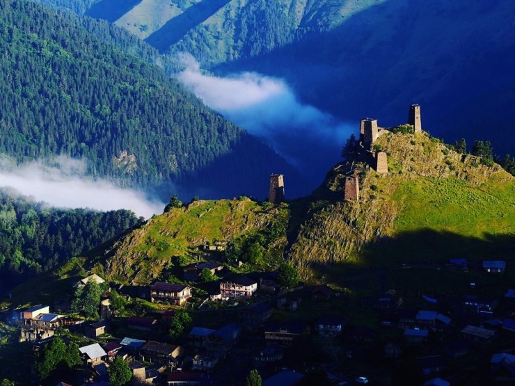
The village of Omalo lies in the mountainous region of Tusheti in northern Georgia, which politically belongs to the municipality of Akhmeta in Kakheti. The largest village in Tusheti, Omalo, is its administrative center.
Omalo is located at 1,880 meters above sea level and is only connected to the rest of the world via the Tusheti Roa. However, this road is closed during at least half of the year, which is why Omalo can usually only be visited between May and September.
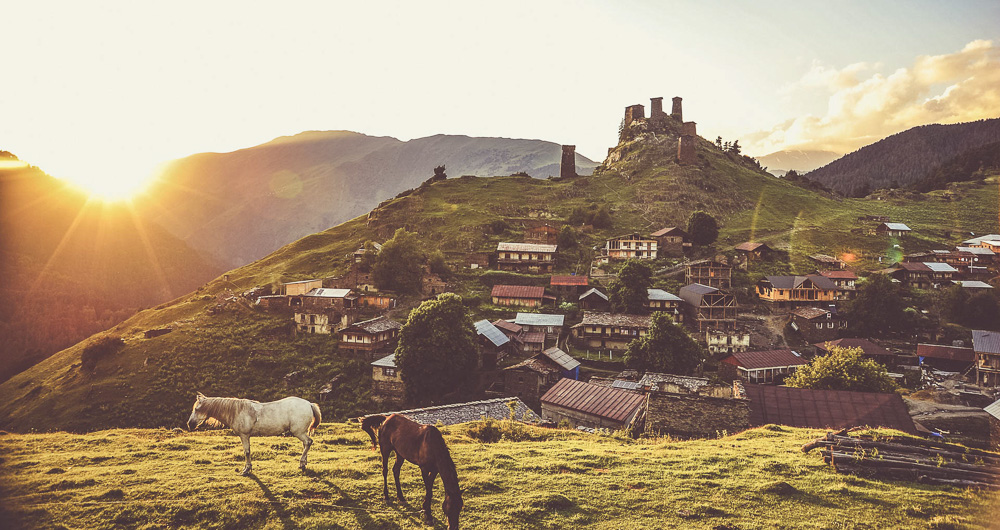
The Tushetians, as the population of Omalo and the whole of Tusheti is called, had always sought refuge in their defensive towers during hostile attacks. This was also the case in the 1230s during the invasion of the Mongolians. At this time, the fortress Keselo was built. And it still remains there today on a steep hill above the upper part of the village.
Keselo originally consisted of 13 towers, most of which turned into ruins over the centuries. It was not until 2003 that a private initiative of two Dutch people living in Georgia began to rebuild the towers. Later, the Keselo Foundation was founded, which helped to rebuild the Keselo Towers according to the old Tushetian tradition.